
What Is the Model Rocket Altitude Calculator?
This calculator estimates how high your model rocket flew (its apogee) using a classic single-station tracking method. You stand a known distance from the launch pad, point a tracker (or smartphone inclinometer) at the rocket when it reaches its highest point, read the elevation angle, and this tool converts those two numbers into an altitude. It's a universal trigonometry tool used by hobbyists, classrooms, and rocketry clubs worldwide.
How to Use It
Measure the straight-line ground distance from your tracking spot to the launch pad — this is the baseline distance. Launch the rocket and, at apogee, record the elevation angle above the horizon. Enter both values and read the estimated altitude in meters and feet.
The Formula Explained
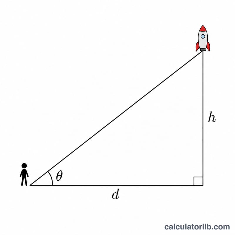
The method treats the rocket, the launch pad, and your tracking position as a right triangle. The baseline distance is the adjacent side, and the altitude is the opposite side. Since \(\tan(\text{angle}) = \text{opposite} / \text{adjacent}\), rearranging gives
$$h = \text{Distance (m)} \times \tan\!\left(\text{Angle} \times \frac{\pi}{180}\right)$$This assumes the rocket flies straight up over the pad and that your eye height is roughly the same as the pad — small deviations introduce error.
Worked Example
You stand 100 m from the pad and measure an elevation angle of 45° at apogee.
$$h = 100 \times \tan(45°) = 100 \times 1 = 100 \text{ m}$$(about 328 ft). If the angle were 60° from the same spot, altitude \(= 100 \times \tan(60°) \approx 173.2 \text{ m}\).
FAQ
Why use a known baseline distance? A single angle alone can't give altitude — you need the horizontal distance to scale the triangle.
How accurate is this? It's a good first estimate. Wind drift away from vertical and inaccurate angle readings are the main error sources. Two-station tracking improves accuracy.
Why can't I enter 90 degrees? The tangent of 90° is infinite, which would imply the rocket is directly overhead at infinite distance. Keep the angle below 90°.